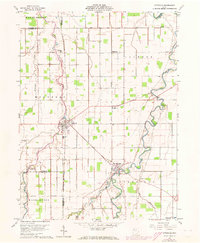
1960 Map of Ottoville
USGS Topo · Published 1973About this map
The Auglaize River and the legacy of the Miami and Erie Canal define this agricultural landscape of western Ohio. By the early 1960s, the canal bed remains a visible corridor through the countryside, running south from Ottoville toward the sharp river bend at Fort Jennings. These two primary settlements anchor the region, which is characterized by a dense network of drainage ditches such as Dry Fork and Flat Foot Creek that converted this former swampland into productive farmland.
Find a feature on this map
31 named features on this map. Tap any name to fly to it.
Don’t see what you’re looking for? This feature index may not catch every label — zoom into the map to look around manually.
Map Details
Editions of this 1960 Ottoville Map
2 editions found
Other maps of this area

1906 · Columbus Grove
USGS Topo · 1:62,500

1908 · Columbus Grove
USGS Topo · 1:62,500

1908 · Ottawa
USGS Topo · 1:62,500

1909 · Continental
USGS Topo · 1:62,500

1911 · Delphos
USGS Topo · 1:62,500

1944 · Delphos
USGS Topo · 1:62,500

1953 · Fort Wayne
USGS Topo · 1:250,000

1953 · Muncie
USGS Topo · 1:250,000

1956 · Muncie
USGS Topo · 1:250,000

1956 · Fort Wayne
USGS Topo · 1:250,000