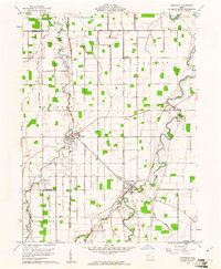
1960 Map of Ottoville
USGS Topo · Published 1961About this map
The Miami and Erie Canal cuts a straight north-south path through the center of this 1960 landscape, serving as a reminder of Ohio's earlier commercial artery even as the modern grid of rural roads and county boundaries takes precedence. Small agricultural hubs like Ottoville and Fort Jennings are detailed with their compact street plans, positioned near the meandering bends of the Auglaize River and the Little Auglaize River. The map reveals a high density of rural cemeteries and community centers, including St Marys Cem, Hammons Cem, and the Antioch Ch, which suggest the deep family roots and local genealogy of Monterey and Jennings townships. The presence of the Chicago And New York rail line and family-named landmarks like Carpenter Road underscores the transition between nineteenth-century transport and twentieth-century rural development.
Find a feature on this map
30 named features on this map. Tap any name to fly to it.
Don’t see what you’re looking for? This feature index may not catch every label — zoom into the map to look around manually.
Map Details
Editions of this 1960 Ottoville Map
2 editions found
Other maps of this area

1906 · Columbus Grove
USGS Topo · 1:62,500

1908 · Columbus Grove
USGS Topo · 1:62,500

1908 · Ottawa
USGS Topo · 1:62,500

1909 · Continental
USGS Topo · 1:62,500

1911 · Delphos
USGS Topo · 1:62,500

1944 · Delphos
USGS Topo · 1:62,500

1953 · Fort Wayne
USGS Topo · 1:250,000

1953 · Muncie
USGS Topo · 1:250,000

1956 · Muncie
USGS Topo · 1:250,000

1956 · Fort Wayne
USGS Topo · 1:250,000