
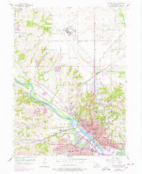
1956 Map of Ottumwa North
USGS Topo · Published 1958About this map
The Des Moines River cuts through the heart of this mid-1950s landscape, anchoring the industrial and civic core of Ottumwa. During this period of post-war expansion, the city's infrastructure is prominently displayed, from the Waterworks and Sewage Disposal plant to the large Ottumwa Municipal Airport in Richland. Educational and healthcare facilities are particularly dense, featuring the Ottumwa Heights College, Walsh High Sch, and the Sunnyslope Sanatorium.
Find a feature on this map
72 named features on this map. Tap any name to fly to it.
Don’t see what you’re looking for? This feature index may not catch every label — zoom into the map to look around manually.
Map Details
Editions of this 1956 Ottumwa North Map
2 editions found
Other maps of this area

1954 · Centerville
USGS Topo · 1:250,000

1954 · Des Moines
USGS Topo · 1:250,000

1956 · Des Moines
USGS Topo · 1:250,000

1956 · Farson
USGS Topo · 1:24,000

1956 · Agency
USGS Topo · 1:24,000

1956 · Ottumwa North
USGS Topo · 1:62,500

1956 · Ottumwa South
USGS Topo · 1:24,000

1956 · Ottumwa South
USGS Topo · 1:62,500

1957 · Des Moines
USGS Topo · 1:250,000

1957 · Centerville
USGS Topo · 1:250,000