
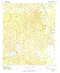
1971 Map of Ouachita
USGS Topo · Published 1973About this map
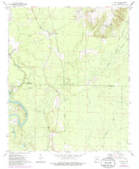
Ouachita River meanders through the southern lowlands of the Arkansas timberlands, defining the boundary between Dallas and Ouachita counties in this early 1970s survey. The landscape is characterized by a dense network of water bodies, including Shell Lake, Georgia Lake, and Utley Lake, which suggest a seasonal floodplain environment. Small rural settlements like Ouachita and Smead serve as the primary human hubs, anchored by local institutions such as Smead Ch and the Brazeale Cem.
Find a feature on this map
18 named features on this map. Tap any name to fly to it.
Don’t see what you’re looking for? This feature index may not catch every label — zoom into the map to look around manually.
Map Details
Editions of this 1971 Ouachita Map
2 editions found
Other maps of this area

1903 · Camden
USGS Topo · 1:125,000

1953 · El Dorado
USGS Topo · 1:250,000

1957 · El Dorado
USGS Topo · 1:250,000

1958 · El Dorado
USGS Topo · 1:250,000

1960 · El Dorado
USGS Topo · 1:250,000

1971 · Tates Bluff
USGS Topo · 1:24,000
1971 · Sparkman
USGS Topo · 1:24,000
1971 · Harmony Grove
USGS Topo · 1:24,000
1971 · Sparkman NW
USGS Topo · 1:24,000
1971 · Bragg City
USGS Topo · 1:24,000