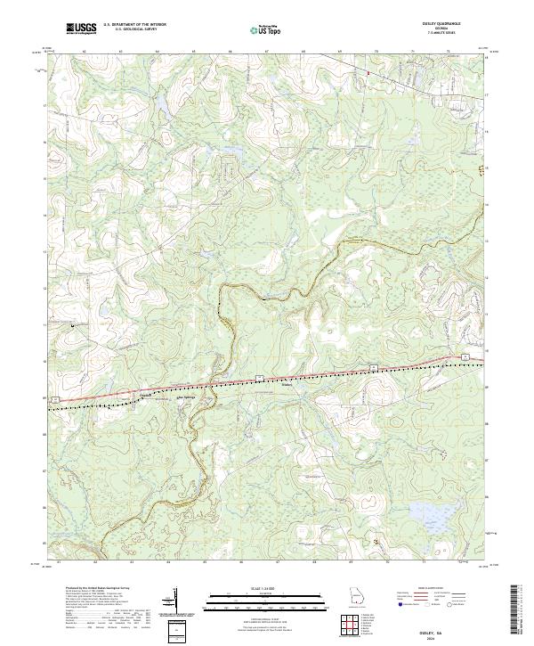
2024 Map of Ousley
USGS Topo · Published 2024About this map
The Withlacoochee River defines the landscape of the Georgia borderlands between Brooks and Lowndes counties, winding through a network of southern tributaries. The small settlement of Ousley is centered along the East-West corridor of the Old Quitman Highway and Thomasville Road, supported by the neighboring communities of Durden and Blue Springs. This area is characterized by its agricultural drainage systems, where Millrace Creek and Tiger Creek feed into the river's basin.
Find a feature on this map
79 named features on this map. Tap any name to fly to it.
Don’t see what you’re looking for? This feature index may not catch every label — zoom into the map to look around manually.
Map Details
Editions of this 2024 Ousley Map
This is the sole edition of this map. No revisions or reprints were ever made.
Other maps of this area

1954 · Valdosta
USGS Topo · 1:250,000

1956 · Clyattville
USGS Topo · 1:24,000

1956 · Nankin
USGS Topo · 1:24,000

1956 · Baden
USGS Topo · 1:24,000

1958 · Valdosta
USGS Topo · 1:250,000

1959 · Valdosta
USGS Topo · 1:250,000

1961 · Hahira East
USGS Topo · 1:24,000

1961 · Quitman
USGS Topo · 1:62,500

1961 · Valdosta
USGS Topo · 1:24,000

1961 · Hahira West
USGS Topo · 1:24,000