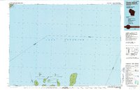
1990 Map of Outer Island
USGS Topo · Published 1991About this map
Lake Superior dominates this late-twentieth-century study of the northernmost reaches of Wisconsin and the Minnesota shoreline. The map centers on the northern archipelago of the Apostle Islands, specifically those within the Apostle Islands National Lakeshore such as Devils Island, Rocky Island, and the elongated Outer Island. These islands, situated within La Pointe Twp, reveal a landscape defined by maritime navigation and conservation rather than dense settlement.
Find a feature on this map
23 named features on this map. Tap any name to fly to it.
Don’t see what you’re looking for? This feature index may not catch every label — zoom into the map to look around manually.
Map Details
Editions of this 1990 Outer Island Map
This is the sole edition of this map. No revisions or reprints were ever made.
Other maps of this area

1919 · Grand Marais
USGS Topo · 1:62,500

1919 · Lutsen
USGS Topo · 1:62,500

1941 · Bayfield
USGS Topo · 1:48,000

1944 · Cornucopia
USGS Topo · 1:48,000

1946 · Cornucopia
USGS Topo · 1:48,000

1946 · Bayfield
USGS Topo · 1:48,000

1953 · Ashland
USGS Topo · 1:250,000

1954 · Two Harbors
USGS Topo · 1:250,000

1955 · Tofte
USGS Topo · 1:24,000

1955 · Schroeder
USGS Topo · 1:24,000