
1959 Map of Outlaw Pond
USGS Topo · Published 1960About this map
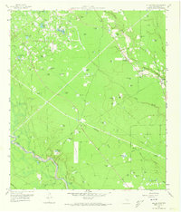
The industrial footprint of the Conroe Oil Field dominates this 1959 landscape, where an extensive network of pipelines and service roads cuts through the wooded terrain of Montgomery County. This era of petroleum extraction is etched into the earth alongside numerous smaller water bodies, from the namesake Outlaw Pond and Sour Pine Pond to recreation-oriented sites like Humble Club Lake. The San Jacinto River Authority's influence is evident in the water management patterns and drainage systems throughout the quadrangle.
Find a feature on this map
69 named features on this map. Tap any name to fly to it.
Don’t see what you’re looking for? This feature index may not catch every label — zoom into the map to look around manually.
Map Details
Editions of this 1959 Outlaw Pond Map
Other maps of this area

1916 · Moonshine Hill
USGS Topo · 1:24,000

1916 · Spring
USGS Topo · 1:24,000

1919 · Weeden
USGS Topo · 1:31,680

1920 · Spring
USGS Topo · 1:31,680

1920 · Moonshine Hill
USGS Topo · 1:31,680

1954 · Beaumont
USGS Topo · 1:250,000

1957 · Beaumont
USGS Topo · 1:250,000

1958 · Conroe
USGS Topo · 1:24,000

1958 · Fostoria
USGS Topo · 1:24,000

1959 · Cut and Shoot
USGS Topo · 1:24,000