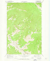
1969 Map of Oval Peak
USGS Topo · Published 1973About this map
Oval Peak serves as a central anchor for this high-altitude landscape within the Okanogan National Forest and Wenatchee National Forest. The topography is defined by the sharp divide of Sawtooth Ridge, which also marks the political boundary between Okanogan and Chelan counties. This 1960s survey documents a network of primitive transportation routes, including an extensive pack trail system that connects remote points like Scaffold Camp and Fish Creek Pass. The hydrology of the area is particularly distinct, featuring the high-elevation Oval Lakes cluster—consisting of West Oval Lake, Middle Oval Lake, and East Oval Lake—which feed into Buttermilk Creek. At the northern edge, the Twisp River valley provides access via the War Creek Campground, reflecting the land's transition from river-bottom utility to protected forest wilderness.
Find a feature on this map
38 named features on this map. Tap any name to fly to it.
Don’t see what you’re looking for? This feature index may not catch every label — zoom into the map to look around manually.
Map Details
Editions of this 1969 Oval Peak Map
2 editions found
Other maps of this area

1899 · Methow
USGS Topo · 1:125,000

1901 · Methow
USGS Topo · 1:125,000

1902 · Stehekin
USGS Topo · 1:125,000

1904 · Stehekin
USGS Topo · 1:125,000

1944 · Lucerne
USGS Topo · 1:62,500

1949 · Lucerne
USGS Topo · 1:62,500

1955 · Concrete
USGS Topo · 1:250,000

1958 · Concrete
USGS Topo · 1:250,000

1962 · Concrete
USGS Topo · 1:250,000
1969 · Midnight Mtn.
USGS Topo · 1:24,000