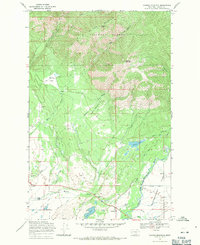
1968 Map of Ovando Mountain
USGS Topo · Published 1971About this map
Ovando serves as the gateway to this portion of the Lolo National Forest, where the landscape transitions from the agricultural Flat to the steep slopes of McCabe Mountain and Ovando Mountain. The map illustrates a developed network of irrigation and livestock infrastructure in the late 1960s, including the Kutar Ditch and Hoffland Lateral which pull water toward local agricultural operations. Notable family-named sites such as Murphy Ranch and Jacobsen Ranch anchor the lower elevations, while the Flat Sch and a local Cem indicate the established community presence at the edge of the wilderness. Higher in the timbered reaches, numerous clearings like Mollet Park and Copenhaver Park provide breaks in the forest canopy, often accessible only via a Pack Trail or Jeep Trail. The North Fork Blackfoot River dominates the southeastern drainage, winding through the plains before entering the more restricted canyons to the north.
Find a feature on this map
35 named features on this map. Tap any name to fly to it.
Don’t see what you’re looking for? This feature index may not catch every label — zoom into the map to look around manually.
Map Details
Editions of this 1968 Ovando Mountain Map
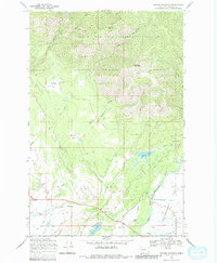
2 editions found
Other maps of this area

1889 · Helena
USGS Topo · 1:250,000

1893 · Helena
USGS Topo · 1:250,000

1899 · Helena
USGS Topo · 1:250,000

1902 · Ovando
USGS Topo · 1:125,000

1903 · Coopers Lake
USGS Topo · 1:125,000

1903 · Helena
USGS Topo · 1:250,000

1905 · Ovando
USGS Topo · 1:125,000

1919 · Drummond
USGS Topo · 1:125,000

1921 · Drummond
USGS Topo · 1:125,000

1947 · Butte
USGS Topo · 1:250,000