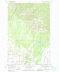
1968 Map of Ovando Mountain
USGS Topo · Published 1982About this map
McCabe Mountain and Ovando Mountain tower over this corner of the Lolo National Forest, where the high peaks give way to the broad alluvial expanse of Kleinschmidt Flat. This landscape is defined by the transition from steep timbered slopes to a ranching economy centered around the settlement of Ovando. The map documents the irrigation and water rights of the era through features like the Hoffland Lateral and numerous ditches that divert water from the North Fork Blackfoot River to sustain the valley floor. Researchers will find a network of historical agricultural life preserved here, from the Flat Sch and local Cem to family-held properties like Jacobsen Ranch and Murphy Ranch. These landholdings are connected by a system of rugged infrastructure, including the Murphy Jeep Trail and Day Falls Road, which provided vital access for both forest management and local ranch operations in the late 1960s.
Find a feature on this map
41 named features on this map. Tap any name to fly to it.
Don’t see what you’re looking for? This feature index may not catch every label — zoom into the map to look around manually.
Map Details
Editions of this 1968 Ovando Mountain Map
2 editions found
Other maps of this area

1889 · Helena
USGS Topo · 1:250,000

1893 · Helena
USGS Topo · 1:250,000

1899 · Helena
USGS Topo · 1:250,000

1902 · Ovando
USGS Topo · 1:125,000

1903 · Coopers Lake
USGS Topo · 1:125,000

1903 · Helena
USGS Topo · 1:250,000

1905 · Ovando
USGS Topo · 1:125,000

1919 · Drummond
USGS Topo · 1:125,000

1921 · Drummond
USGS Topo · 1:125,000

1947 · Butte
USGS Topo · 1:250,000