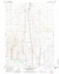
1955 Map of Overland
USGS Topo · Published 1983About this map
Midway (Old Stage Station) and the Overland Trail anchor this mid-century look at Carbon County, marking a corridor of westward expansion that predates the modern infrastructure shown here. The map traces the transition from historic wagon routes to the industrial presence of the Union Pacific railroad and a prominent north-south Pipeline. In the southern portion, the North Platte River winds through the landscape near Byers Ranch, supported by an intricate system of water management including the Pick Ditch and Brauer Ditch.
Find a feature on this map
34 named features on this map. Tap any name to fly to it.
Don’t see what you’re looking for? This feature index may not catch every label — zoom into the map to look around manually.
Map Details
Editions of this 1955 Overland Map
3 editions found
Other maps of this area

1893 · Fort Steele
USGS Topo · 1:125,000

1939 · Saratoga
USGS Topo · 1:125,000

1954 · Rawlins
USGS Topo · 1:250,000

1955 · Overland
USGS Topo · 1:24,000

1955 · Overland Crossing
USGS Topo · 1:24,000

1955 · Coal Bank Basin
USGS Topo · 1:24,000

1955 · Oberg Ranch
USGS Topo · 1:24,000

1955 · Meads
USGS Topo · 1:24,000

1955 · Savage Ranch
USGS Topo · 1:24,000

1958 · Rawlins
USGS Topo · 1:250,000