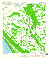
1943 Map of Overstreet
USGS Topo · Published 1960About this map
Overstreet occupies a strategic position along the Intracoastal Waterway in this wartime-era survey of Gulf County. The landscape is a complex network of wetlands and drainage, where the dredged canal cuts through established features like Devils Elbow and The Kink. The mapping provides unique local context through named sites such as the Sharp Hardy Homestead and Ringjaw Camp, which suggest the sparse but persistent human footprint in this coastal region.
Find a feature on this map
23 named features on this map. Tap any name to fly to it.
Don’t see what you’re looking for? This feature index may not catch every label — zoom into the map to look around manually.
Map Details
Editions of this 1943 Overstreet Map
5 editions found
Other maps of this area

1943 · Port St. Joe
USGS Topo · 1:31,680

1943 · Overstreet
USGS Topo · 1:31,680

1944 · Beacon Hill
USGS Topo · 1:31,680

1944 · White City
USGS Topo · 1:24,000

1945 · Lake Wimico
USGS Topo · 1:31,680

1945 · White City
USGS Topo · 1:31,680

1945 · Allanton
USGS Topo · 1:31,680

1945 · Wewahitchka
USGS Topo · 1:31,680

1945 · Wetappo Creek
USGS Topo · 1:31,680

1945 · St Joseph Point
USGS Topo · 1:31,680