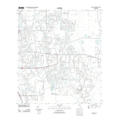
2012 Map of Oviedo SW
USGS Topo · Published 2012About this map
The University of Central Florida serves as a major focal point for this region of Orange County, anchoring a landscape where academic expansion meets residential growth. The geography is defined by a series of small water bodies, including Lake Georgia and Lake Phillips, which are interspersed among suburban developments like University Park and Alafaya. This 2012 survey illustrates the modern road network, with thoroughfares such as Research Pkwy and Waterford Lakes Pkwy connecting the campus to local residential hubs.
Find a feature on this map
37 named features on this map. Tap any name to fly to it.
Don’t see what you’re looking for? This feature index may not catch every label — zoom into the map to look around manually.
Map Details
Editions of this 2012 Oviedo SW Map
This is the sole edition of this map. No revisions or reprints were ever made.
Other maps of this area

1953 · Narcoossee NE
USGS Topo · 1:24,000

1953 · Pine Castle
USGS Topo · 1:24,000

1953 · Geneva
USGS Topo · 1:24,000

1953 · Oviedo SW
USGS Topo · 1:24,000

1953 · Narcoossee NW
USGS Topo · 1:24,000

1953 · Bithlo
USGS Topo · 1:24,000

1955 · Orlando
USGS Topo · 1:250,000

1956 · Oviedo
USGS Topo · 1:24,000

1956 · Orlando East
USGS Topo · 1:24,000

1957 · Orlando
USGS Topo · 1:250,000