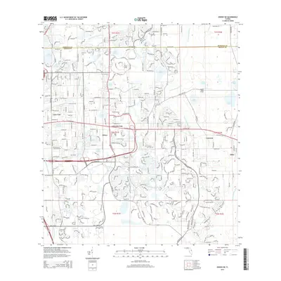
2015 Map of Oviedo SW
USGS Topo · Published 2015About this map
Univ of Central Florida serves as a prominent institutional anchor within this landscape of suburban expansion and natural waterways. The geography is defined by the winding courses of the Little Econlockhatchee River and the Econlockhatchee River, which thread through various residential developments and clusters of small lakes. The map documents the established communities of Alafaya, University Park, and Union Park, where high-density street networks contrast with the more dispersed settlements of Lockwood and Bithlo to the east.
Find a feature on this map
36 named features on this map. Tap any name to fly to it.
Don’t see what you’re looking for? This feature index may not catch every label — zoom into the map to look around manually.
Map Details
Editions of this 2015 Oviedo SW Map
This is the sole edition of this map. No revisions or reprints were ever made.
Other maps of this area

1953 · Narcoossee NE
USGS Topo · 1:24,000

1953 · Pine Castle
USGS Topo · 1:24,000

1953 · Geneva
USGS Topo · 1:24,000

1953 · Oviedo SW
USGS Topo · 1:24,000

1953 · Narcoossee NW
USGS Topo · 1:24,000

1953 · Bithlo
USGS Topo · 1:24,000

1955 · Orlando
USGS Topo · 1:250,000

1956 · Oviedo
USGS Topo · 1:24,000

1956 · Orlando East
USGS Topo · 1:24,000

1957 · Orlando
USGS Topo · 1:250,000