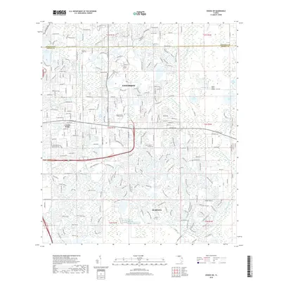
2018 Map of Oviedo SW
USGS Topo · Published 2018About this map
The Univ of Central Florida serves as a massive academic anchor for this part of Orange County, where suburban expansion meets the winding corridors of the Little Econlockhatchee River. This 2018 survey illustrates the intense development surrounding the University and Alafaya districts, showing a landscape defined by collegiate infrastructure, research parks, and dense residential communities. Amidst this modern growth, traditional landmarks like the Drawdy-Rouse Cem and the Rybolt Ranch Airport provide historical context to the area's transition from rural ranching and citrus land into a sprawling educational and technological hub. Dozens of small lakes, such as Lake Rouse, Lake Downey, and Lake Claire, are woven into the neighborhood fabric, serving as central features for the many subdivisions that have emerged along E Colonial Dr and Alafaya Trl.
Find a feature on this map
47 named features on this map. Tap any name to fly to it.
Don’t see what you’re looking for? This feature index may not catch every label — zoom into the map to look around manually.
Map Details
Editions of this 2018 Oviedo SW Map
This is the sole edition of this map. No revisions or reprints were ever made.
Other maps of this area

1953 · Narcoossee NE
USGS Topo · 1:24,000

1953 · Pine Castle
USGS Topo · 1:24,000

1953 · Geneva
USGS Topo · 1:24,000

1953 · Oviedo SW
USGS Topo · 1:24,000

1953 · Narcoossee NW
USGS Topo · 1:24,000

1953 · Bithlo
USGS Topo · 1:24,000

1955 · Orlando
USGS Topo · 1:250,000

1956 · Oviedo
USGS Topo · 1:24,000

1956 · Orlando East
USGS Topo · 1:24,000

1957 · Orlando
USGS Topo · 1:250,000