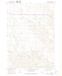
1954 Map of Owanka
USGS Topo · Published 1979About this map
The Chicago and North Western rail line cuts across the southern portion of this landscape, anchoring the settlement of Owanka near the banks of Boxelder Creek. This mid-century survey illustrates a sparse ranching and farming environment, where life centered around small rural institutions like the Owanka Cem and a network of country schools including Simon Sch, Wayside Sch, and Fuller Sch.
Find a feature on this map
17 named features on this map. Tap any name to fly to it.
Don’t see what you’re looking for? This feature index may not catch every label — zoom into the map to look around manually.
Map Details
Editions of this 1954 Owanka Map
3 editions found
Other maps of this area

1953 · Rapid City
USGS Topo · 1:250,000

1954 · Wasta
USGS Topo · 1:24,000

1954 · Owanka
USGS Topo · 1:24,000

1954 · Creston
USGS Topo · 1:24,000

1954 · Wasta NW
USGS Topo · 1:24,000

1954 · Brennan Flat
USGS Topo · 1:24,000

1954 · Quinn Table
USGS Topo · 1:24,000

1955 · Hot Springs
USGS Topo · 1:250,000

1957 · Rapid City
USGS Topo · 1:250,000
1957 · Owanka NE
USGS Topo · 1:24,000