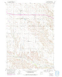
1954 Map of Owanka
USGS Topo · Published 1979About this map
Owanka and the surrounding Pennington County prairie are depicted here during a period of transition in the mid-20th century. The settlement sits along the Chicago and North Western railway, which parallels the winding course of Boxelder Creek. This survey, updated with 1970s revisions, illustrates the persistent rural infrastructure of the Missouri River Basin development era, evidenced by a network of localized schools including Simon Sch, Wayside Sch, and Fuller Sch. The terrain is defined by dramatic drainage patterns such as Pats Draw and Madison Draw, which cut through the high plains toward the deep incision of Hawk Canyon. Genealogists will find the Owanka Cem and the small cluster at Wicksville particularly useful for tracing family ties to this specific corner of South Dakota.
Find a feature on this map
14 named features on this map. Tap any name to fly to it.
Don’t see what you’re looking for? This feature index may not catch every label — zoom into the map to look around manually.
Map Details
Editions of this 1954 Owanka Map
3 editions found
Other maps of this area

1953 · Rapid City
USGS Topo · 1:250,000

1954 · Wasta
USGS Topo · 1:24,000

1954 · Owanka
USGS Topo · 1:24,000

1954 · Creston
USGS Topo · 1:24,000

1954 · Wasta NW
USGS Topo · 1:24,000

1954 · Brennan Flat
USGS Topo · 1:24,000

1954 · Quinn Table
USGS Topo · 1:24,000

1955 · Hot Springs
USGS Topo · 1:250,000

1957 · Rapid City
USGS Topo · 1:250,000
1957 · Owanka NE
USGS Topo · 1:24,000