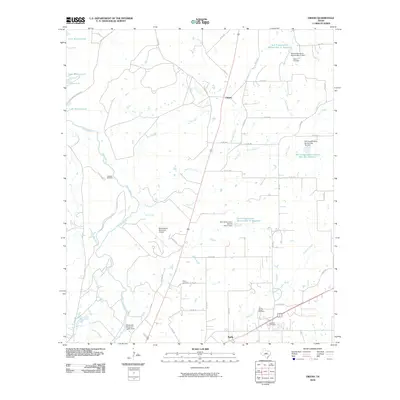
2010 Map of Owens
USGS Topo · Published 2010About this map
Pecan Bayou and its numerous tributaries, including Elm Creek, Red Hole Creek, and Delaware Creek, define the landscape of this Central Texas corridor. The 2010 landscape reflects a transition from the sprawling waters of Lake Brownwood and Buzzard Bay in the northwest toward the developing hub of Early in the southeast. Water management is a central theme, evidenced by several Soil Conservation Service reservoirs and the Municipal Reservoir Lower Dam. Genealogists will find a wealth of local history preserved in the region's burial grounds, from the Heflin Cemetery and Staley Cemetery to the Jones Chapel Cemetery and Roberts Cemetery. The industrial and transportation infrastructure of the era is anchored by the Brownwood Municipal Airport and a network of Farm to Market roads like FM 3100 and FM 1467 that link the small settlement of Owens to the surrounding ranching and residential areas.
Find a feature on this map
51 named features on this map. Tap any name to fly to it.
Don’t see what you’re looking for? This feature index may not catch every label — zoom into the map to look around manually.
Map Details
Editions of this 2010 Owens Map
This is the sole edition of this map. No revisions or reprints were ever made.
Other maps of this area

1887 · Coleman
USGS Topo · 1:125,000

1889 · Brownwood
USGS Topo · 1:125,000

1889 · Coleman
USGS Topo · 1:125,000

1894 · Brownwood
USGS Topo · 1:125,000

1924 · Coleman 1-a
USGS Topo · 1:48,000

1924 · Brownwood Reservoir Site
USGS Topo · 1:48,000

1925 · Brownwood 3-b
USGS Topo · 1:48,000

1927 · Grosvenor
USGS Topo · 1:62,500

1928 · Zephyr
USGS Topo · 1:62,500

1950 · Zephyr
USGS Topo · 1:62,500