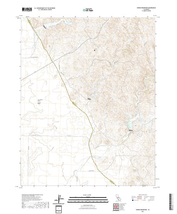
2021 Map of Owens Reservoir
USGS Topo · Published 2021About this map
San Joaquin Valley ranchlands and rolling hills define this 2021 landscape along the boundary of Mariposa and Merced counties. The area is defined by a series of southwest-flowing waterways, including Bear Creek, Miles Creek, and Owens Creek, which drain the foothills toward the Central Valley floor. This modern survey illustrates the persistent rural character of the region, where historical footprints like Pate Cemetery remain situated among large agricultural sections. A network of secondary roads and tracks, such as Owens Dam Road, Ranch Trail, and White Rock Road, provides access to the dispersed holdings and water management infrastructure. The map details the precise topography and drainage patterns of Mariposa Creek and its tributary Ganns Creek as they traverse the township and range grid.
Find a feature on this map
24 named features on this map. Tap any name to fly to it.
Don’t see what you’re looking for? This feature index may not catch every label — zoom into the map to look around manually.
Map Details
Editions of this 2021 Owens Reservoir Map
This is the sole edition of this map. No revisions or reprints were ever made.
Other maps of this area

1915 · Owens Creek
USGS Topo · 1:31,680

1918 · Owens Creek
USGS Topo · 1:31,680

1918 · Planada
USGS Topo · 1:31,680

1918 · La Grand
USGS Topo · 1:31,680

1919 · Indian Gulch
USGS Topo · 1:48,000

1919 · Haystack Mountain
USGS Topo · 1:31,680

1919 · Plainsberg
USGS Topo · 1:31,680

1919 · Raynor Creek
USGS Topo · 1:31,680

1920 · Indian Gulch
USGS Topo · 1:62,500
1942 · Athlone
USGS Topo · 1:62,500