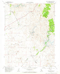
1962 Map of Owens Reservoir
USGS Topo · Published 1963About this map
Mariposa Reservoir and its surrounding water management systems anchor this early 1960s study of the foothills where Merced and Mariposa Counties meet. The landscape is defined by the hydrologic network of Bear Creek, Miles Creek, and Owens Creek, each supporting distinct agricultural operations like the Chase Ranch and Cunningham Ranch. An Indefinite Boundary separates the two counties, cutting through a terrain marked by small-scale resource extraction, including several Quarries and the Hills Mine in the northern hills.
Find a feature on this map
28 named features on this map. Tap any name to fly to it.
Don’t see what you’re looking for? This feature index may not catch every label — zoom into the map to look around manually.
Map Details
Editions of this 1962 Owens Reservoir Map
This is the sole edition of this map. No revisions or reprints were ever made.
Other maps of this area

1915 · Owens Creek
USGS Topo · 1:31,680

1918 · Owens Creek
USGS Topo · 1:31,680

1918 · Planada
USGS Topo · 1:31,680

1918 · La Grand
USGS Topo · 1:31,680

1919 · Indian Gulch
USGS Topo · 1:48,000

1919 · Haystack Mountain
USGS Topo · 1:31,680

1919 · Plainsberg
USGS Topo · 1:31,680

1919 · Raynor Creek
USGS Topo · 1:31,680

1920 · Indian Gulch
USGS Topo · 1:62,500
1942 · Athlone
USGS Topo · 1:62,500