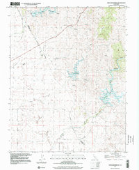
1999 Map of Owens Reservoir
USGS Topo · Published 2002About this map
Owens Reservoir and Mariposa Reservoir anchor this landscape along the Merced and Mariposa County line, reflecting a region managed for water and mineral resources. The survey records a working landscape where industrial history is written into the terrain, most notably through Dredge Tailings and several Quarries that follow the creek beds. Local family history and early settlement patterns are visible at the Pate Cem and namesake holdings like Chase Ranch and Cunningham Ranch. The topography is defined by the drainage systems of Owens Creek and Mariposa Creek, which have been transformed by engineering to support the surrounding valley. This late-twentieth-century update captures the area after the major reservoirs were established but before significant modern development, preserving the footprint of the Hills Mine and the rural road network including Waltz Road and Whiterock Road.
Find a feature on this map
21 named features on this map. Tap any name to fly to it.
Don’t see what you’re looking for? This feature index may not catch every label — zoom into the map to look around manually.
Map Details
Editions of this 1999 Owens Reservoir Map
This is the sole edition of this map. No revisions or reprints were ever made.
Other maps of this area

1915 · Owens Creek
USGS Topo · 1:31,680

1918 · Owens Creek
USGS Topo · 1:31,680

1918 · Planada
USGS Topo · 1:31,680

1918 · La Grand
USGS Topo · 1:31,680

1919 · Indian Gulch
USGS Topo · 1:48,000

1919 · Haystack Mountain
USGS Topo · 1:31,680

1919 · Plainsberg
USGS Topo · 1:31,680

1919 · Raynor Creek
USGS Topo · 1:31,680

1920 · Indian Gulch
USGS Topo · 1:62,500
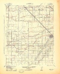
1942 · Athlone
USGS Topo · 1:62,500