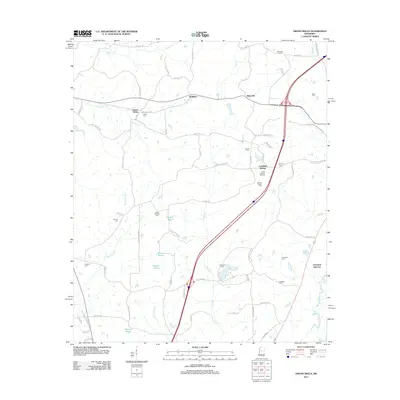
2012 Map of Owens Wells
USGS Topo · Published 2012About this map
Castalian Springs and the healing waters of Owens Wells anchor this Mississippi landscape, reflecting a region defined by its natural springs and proximity to Holmes Co State Park. The terrain is etched by the meandering Bisland Bayou and Tarrey Cr, with small communities like McMillan and West Hill scattered along the northern corridor. These settlements developed as transit points between the local agricultural land and the regional rail connections at Aberdeen Junction.
Find a feature on this map
70 named features on this map. Tap any name to fly to it.
Don’t see what you’re looking for? This feature index may not catch every label — zoom into the map to look around manually.
Map Details
Editions of this 2012 Owens Wells Map
This is the sole edition of this map. No revisions or reprints were ever made.
Other maps of this area

1940 · Lexington
USGS Topo · 1:62,500

1953 · Meridian
USGS Topo · 1:250,000

1953 · Greenwood
USGS Topo · 1:250,000

1953 · West Point
USGS Topo · 1:250,000

1955 · Jackson
USGS Topo · 1:250,000

1956 · Greenwood
USGS Topo · 1:250,000

1957 · Meridian
USGS Topo · 1:250,000

1957 · Lexington
USGS Topo · 1:62,500

1958 · West Point
USGS Topo · 1:250,000

1958 · Lexington
USGS Topo · 1:62,500