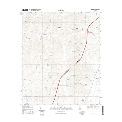
2015 Map of Owens Wells
USGS Topo · Published 2015About this map
Owens Wells and the surrounding Holmes County landscape are defined by a network of rural settlements and cemeteries linked by a intricate web of country roads. The area near Castalian Springs and West Hill shows a distribution of family-named landmarks and local institutions, including the Wesley Chapel and numerous burial grounds like Owen Cem and Sproles Cem. The terrain is drained by several water systems, most notably the meandering Bisland Bayou and Big Cypress Cr, which cut through the township divisions of T14N and T15N. This survey documents the transition between upland ridges and the lower drainage basins, where small communities like McMillan and Aberdeen Junction grew around the local road network, including Castalian Springs Rd and State Park Rd. The high density of cemeteries such as Gages Springs Cem and Durham Cem provides significant points of interest for genealogical research in this part of Mississippi.
Find a feature on this map
70 named features on this map. Tap any name to fly to it.
Don’t see what you’re looking for? This feature index may not catch every label — zoom into the map to look around manually.
Map Details
Editions of this 2015 Owens Wells Map
This is the sole edition of this map. No revisions or reprints were ever made.
Other maps of this area
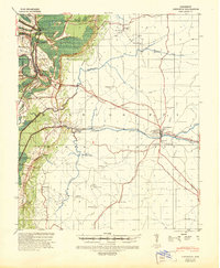
1940 · Lexington
USGS Topo · 1:62,500
1953 · Meridian
USGS Topo · 1:250,000

1953 · Greenwood
USGS Topo · 1:250,000
1953 · West Point
USGS Topo · 1:250,000

1955 · Jackson
USGS Topo · 1:250,000

1956 · Greenwood
USGS Topo · 1:250,000
1957 · Meridian
USGS Topo · 1:250,000
1957 · Lexington
USGS Topo · 1:62,500
1958 · West Point
USGS Topo · 1:250,000
1958 · Lexington
USGS Topo · 1:62,500