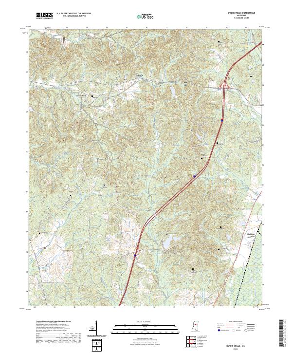
2024 Map of Owens Wells
USGS Topo · Published 2024About this map
Owens Wells sits at a crossroads of small settlements and family burial grounds in rural Mississippi, where the landscape is defined by the winding paths of Bisland Bayou and Tarrey Creek. The area is notably dense with local history markers, particularly cemeteries that trace family lineages through the countryside, such as Owen Cem and Barksdale Cem. Near the center of the sheet, the McMillan settlement and West Hill represent the quiet residential character of Holmes County. The topography is shaped by numerous tributaries, including Shipp Creek and Big Cypress Creek, which historically dictated the placement of roads like Castalian Springs Rd and Owens Cut-Off Rd. Further south, Aberdeen Junction marks a point of historical transition near the wetlands and lowlands of the bayou system.
Find a feature on this map
66 named features on this map. Tap any name to fly to it.
Don’t see what you’re looking for? This feature index may not catch every label — zoom into the map to look around manually.
Map Details
Editions of this 2024 Owens Wells Map
This is the sole edition of this map. No revisions or reprints were ever made.
Other maps of this area

1940 · Lexington
USGS Topo · 1:62,500

1953 · Meridian
USGS Topo · 1:250,000

1953 · Greenwood
USGS Topo · 1:250,000

1953 · West Point
USGS Topo · 1:250,000

1955 · Jackson
USGS Topo · 1:250,000

1956 · Greenwood
USGS Topo · 1:250,000

1957 · Meridian
USGS Topo · 1:250,000

1957 · Lexington
USGS Topo · 1:62,500

1958 · West Point
USGS Topo · 1:250,000

1958 · Lexington
USGS Topo · 1:62,500