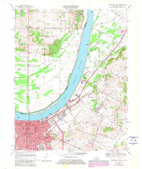
1967 Map of Owensboro East
USGS Topo · Published 1981About this map
The city of Owensboro dominates the southwestern portion of this map, showcasing its transition from a riverside hub to a larger urban center by the late 1960s. The downtown area is meticulously detailed, including the Courthouse, City Hall, and Library, alongside educational institutions like Brescia College and Technical High School. The industrial and transport importance of the era is evident through the path of the Louisville and Nashville railroad and the presence of a large Pipeline corridor.
Find a feature on this map
47 named features on this map. Tap any name to fly to it.
Don’t see what you’re looking for? This feature index may not catch every label — zoom into the map to look around manually.
Map Details
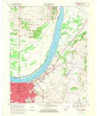
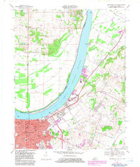
Editions of this 1967 Owensboro East Map
3 editions found
Other maps of this area

1901 · Owensboro
USGS Topo · 1:62,500

1903 · Tell City
USGS Topo · 1:62,500

1906 · Sutherland
USGS Topo · 1:62,500

1907 · Whitesville
USGS Topo · 1:62,500

1909 · Whitesville
USGS Topo · 1:62,500

1952 · Owensboro East
USGS Topo · 1:24,000

1952 · Rockport
USGS Topo · 1:24,000

1952 · Owensboro West
USGS Topo · 1:24,000

1953 · Philpot
USGS Topo · 1:24,000

1953 · Sutherland
USGS Topo · 1:24,000