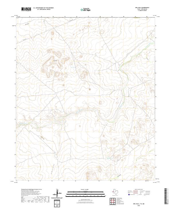
2022 Map of Owl Hills
USGS Topo · Published 2022About this map
The Delaware River cuts a prominent path through this corner of Culberson County, defining the arid hydrology of the Trans-Pecos landscape. The eponymous Owl Hills dominate the western portion of the sheet, surrounded by a network of ephemeral watercourses including Owl Draw, Kimbell Draw, and China Draw. These drainage patterns are critical markers for understanding the historical movement of livestock and people through this desert environment. Water management infrastructure, essential for ranching in this dry climate, is represented by isolated features like Owl Tank and Brushy Tank. Human impact on the land is further evidenced by the industrial presence of Pipeline Rd, which traverses the northern reaches of the quadrangle, contrasting with the natural geologic formations like Gyp Draw.
Find a feature on this map
10 named features on this map. Tap any name to fly to it.
Don’t see what you’re looking for? This feature index may not catch every label — zoom into the map to look around manually.
Map Details
Editions of this 2022 Owl Hills Map
This is the sole edition of this map. No revisions or reprints were ever made.
Other maps of this area

1945 · Carlsbad Caverns East
USGS Topo · 1:62,500

1945 · Malaga
USGS Topo · 1:62,500

1946 · Malaga
USGS Topo · 1:62,500

1947 · Carlsbad Caverns East
USGS Topo · 1:62,500

1954 · Carlsbad
USGS Topo · 1:250,000

1954 · Van Horn
USGS Topo · 1:250,000

1958 · Van Horn
USGS Topo · 1:250,000

1958 · Carlsbad
USGS Topo · 1:250,000

1973 · Owl Hills
USGS Topo · 1:24,000

1973 · Screw Bean Draw West
USGS Topo · 1:24,000