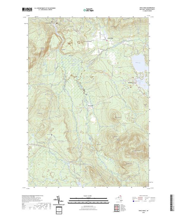
2023 Map of Owls Head
USGS Topo · Published 2023About this map
Chasm Falls and the surrounding northern edges of Adirondack Park define this landscape of interconnected waters and high ridges. The Salmon River winds through the center of the sheet, feeding the Oxbow and Huckleberry Marsh, while the eastern reaches are dominated by Mountain View Lake and Indian Lake. This area of Franklin County maintains a character shaped by its rugged topography, featuring prominent elevations like the Owls Head Range and the Plumadore Range.
Find a feature on this map
90 named features on this map. Tap any name to fly to it.
Don’t see what you’re looking for? This feature index may not catch every label — zoom into the map to look around manually.
Map Details
Editions of this 2023 Owls Head Map
This is the sole edition of this map. No revisions or reprints were ever made.
Other maps of this area

1906 · Loon Lake
USGS Topo · 1:62,500

1908 · Loon Lake
USGS Topo · 1:62,500

1915 · Chateaugay
USGS Topo · 1:62,500

1915 · Malone
USGS Topo · 1:62,500

1917 · Malone
USGS Topo · 1:62,500

1921 · Santa Clara
USGS Topo · 1:62,500

1923 · Santa Clara
USGS Topo · 1:62,500

1943 · Chateaugay
USGS Topo · 1:62,500

1948 · Ogdensburg
USGS Topo · 1:250,000

1951 · Ogdensburg
USGS Topo · 1:250,000