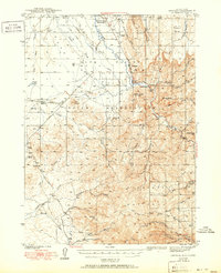
1942 Map of Owyhee
USGS Topo · Published 1951About this map
The Duck Valley Indian Reservation straddles the Idaho and Nevada border, defining the northern landscape of this Elko County survey. Following the Owyhee River through the heart of the valley, the map details an extensive irrigation network crucial to the local economy, including the Duck Valley Canal, Thacker Lateral, and the China Dam. Small residential hubs like Owyhee and the Number One Settlement serve as the primary anchors for the community.
Find a feature on this map
58 named features on this map. Tap any name to fly to it.
Don’t see what you’re looking for? This feature index may not catch every label — zoom into the map to look around manually.
Map Details
Editions of this 1942 Owyhee Map
3 editions found
Other maps of this area

1936 · Mountain City
USGS Topo · 1:62,500

1939 · Owyhee
USGS Topo · 1:62,500

1940 · Mountain City
USGS Topo · 1:62,500

1942 · Owyhee
USGS Topo · 1:62,500

1955 · McDermitt
USGS Topo · 1:250,000

1955 · Jordan Valley
USGS Topo · 1:250,000

1955 · Twin Falls
USGS Topo · 1:250,000

1955 · Wells
USGS Topo · 1:250,000

1956 · Bull Run
USGS Topo · 1:62,500

1956 · Wild Horse
USGS Topo · 1:62,500