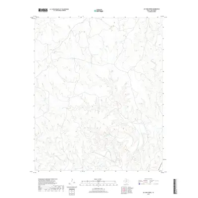
2019 Map of Ox Yoke Creek
USGS Topo · Published 2019About this map
The South Wichita River meanders across this West Texas landscape in King County, shaping a complex network of draws and seasonal drainages. This high-plains environment is characterized by its hydrological features rather than human settlements, with the Ox Yoke Cr and Bird Cr systems feeding into the river's main channel. The terrain is marked by significant elevation changes, most notably at Big Getaway Canyon in the southeast corner. Local water management is represented by Jerrys Tank, a critical resource for livestock in this semi-arid ranching country. Other smaller watercourses including Spring Cr, Bitter Cr, and Dikes Cr further illustrate the watershed patterns that define land use and property boundaries in this sparsely populated region of the state.
Find a feature on this map
8 named features on this map. Tap any name to fly to it.
Don’t see what you’re looking for? This feature index may not catch every label — zoom into the map to look around manually.
Map Details
Editions of this 2019 Ox Yoke Creek Map
This is the sole edition of this map. No revisions or reprints were ever made.
Other maps of this area
1954 · Lubbock
USGS Topo · 1:250,000
1954 · Wichita Falls
USGS Topo · 1:250,000
1958 · Wichita Falls
USGS Topo · 1:250,000
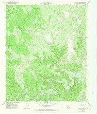
1966 · Ox Yoke Creek
USGS Topo · 1:24,000
1966 · Chalk SW
USGS Topo · 1:24,000
1966 · Big Four Ranch
USGS Topo · 1:24,000
1966 · J Y Ranch
USGS Topo · 1:24,000
1966 · Maverick Flat
USGS Topo · 1:24,000
1966 · Lowrance Mountain
USGS Topo · 1:24,000
1967 · Cedar Mountain
USGS Topo · 1:24,000