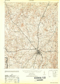
1953 Map of Oxford
USGS Topo · Published 1953About this map
Oxford serves as the focal point of this Granville County landscape, where the convergence of the Southern Railway, Seaboard Railway, and the Atlantic and Danville Railway defines the regional economy. Just north of the Tar River, the map reveals a dense network of rural infrastructure, including numerous family-named schools like Joe Tolers Sch and Michel Sch, and churches such as New Corinth Ch.
Find a feature on this map
73 named features on this map. Tap any name to fly to it.
Don’t see what you’re looking for? This feature index may not catch every label — zoom into the map to look around manually.
Map Details
Editions of this 1953 Oxford Map
2 editions found
Other maps of this area

1941 · Clarksville
USGS Topo · 1:48,000

1943 · Clarksville
USGS Topo · 1:62,500

1943 · Roxboro
USGS Topo · 1:62,500

1943 · Creedmoor
USGS Topo · 1:62,500

1944 · Creedmoor
USGS Topo · 1:62,500

1951 · Durham North
USGS Topo · 1:62,500

1953 · Oxford
USGS Topo · 1:62,500

1953 · South Boston
USGS Topo · 1:62,500

1953 · Greensboro
USGS Topo · 1:250,000

1954 · Greensboro
USGS Topo · 1:250,000