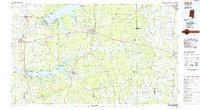
1984 Map of Oxford
USGS Topo · Published 1985About this map
Oxford serves as the focal point of this 1980s-era study, which documents the North Mississippi landscape as the region's university town expanded. The map details the presence of the Univ of Miss and the surrounding network of settlements such as College Hill and Abbeville. The transportation infrastructure of the mid-20th century is clearly visible, featuring the intersection of the Gulf Mobile & Ohio RR and the Illinois Central Gulf RR, reflecting the importance of rail logistics before the full dominance of the interstate system.
Find a feature on this map
106 named features on this map. Tap any name to fly to it.
Don’t see what you’re looking for? This feature index may not catch every label — zoom into the map to look around manually.
Map Details
Editions of this 1984 Oxford Map
This is the sole edition of this map. No revisions or reprints were ever made.
Other maps of this area

1932 · Sledge
USGS Topo · 1:48,000

1932 · Philipp
USGS Topo · 1:48,000

1932 · Crenshaw
USGS Topo · 1:62,500

1935 · Crowder
USGS Topo · 1:62,500

1935 · Crenshaw
USGS Topo · 1:62,500

1935 · Sledge
USGS Topo · 1:62,500

1935 · Philipp
USGS Topo · 1:62,500

1939 · Sledge
USGS Topo · 1:62,500

1939 · Crowder
USGS Topo · 1:62,500

1939 · Philipp
USGS Topo · 1:62,500