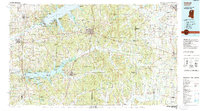
1990 Map of Oxford
USGS Topo · Published 1991About this map
Oxford serves as the central hub of this North Mississippi landscape, where the academic grounds near the University-Oxford Airfield meet the heavily wooded expanse of the Holly Springs National Forest. The geography is defined by the massive reservoirs of Sardis Lake and Enid Lake, created by the Sardis Dam and other water management projects along the Tallahatchie River and Yocona River. These waters altered the regional economy, shifting focus toward recreation at sites like George P Cossar State Park and various public use areas.
Find a feature on this map
135 named features on this map. Tap any name to fly to it.
Don’t see what you’re looking for? This feature index may not catch every label — zoom into the map to look around manually.
Map Details
Editions of this 1990 Oxford Map
This is the sole edition of this map. No revisions or reprints were ever made.
Other maps of this area

1932 · Sledge
USGS Topo · 1:48,000

1932 · Philipp
USGS Topo · 1:48,000

1932 · Crenshaw
USGS Topo · 1:62,500

1935 · Crowder
USGS Topo · 1:62,500

1935 · Crenshaw
USGS Topo · 1:62,500

1935 · Sledge
USGS Topo · 1:62,500

1935 · Philipp
USGS Topo · 1:62,500

1939 · Sledge
USGS Topo · 1:62,500

1939 · Crowder
USGS Topo · 1:62,500

1939 · Philipp
USGS Topo · 1:62,500