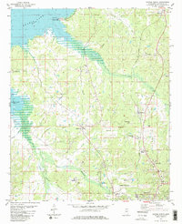
1980 Map of Oxford North
USGS Topo · Published 1981About this map
College Hill and Abbeville anchor this northern Mississippi landscape, where the ridge-and-valley terrain is defined by the Illinois Central Gulf railroad and the rising waters of Sardis Lake. This 1980 survey reveals a community deeply rooted in its local institutions, featuring numerous landmarks such as Springfield Ch, St John Ch, and Buford Chapel. The map documents the northern expansion of Oxford, including the University-Oxford Airfield and the nearby College Hill Sta. Along the shoreline of the reservoir, features like Hurricane Landing Public Use Area and various boat ramps illustrate the area's transition toward recreation, while interior locations like Saddlers Hill and Dry Creek maintain their rural character. Genealogists will find significant value in the documentation of family and community burial sites, including Toby Tubby Cem, Buford Cem, and the St Peter Cem.
Find a feature on this map
39 named features on this map. Tap any name to fly to it.
Don’t see what you’re looking for? This feature index may not catch every label — zoom into the map to look around manually.
Map Details
Editions of this 1980 Oxford North Map
2 editions found
Other maps of this area

1940 · Oxford
USGS Topo · 1:62,500

1942 · Denmark
USGS Topo · 1:62,500

1943 · Denmark
USGS Topo · 1:62,500

1943 · Oxford
USGS Topo · 1:62,500

1944 · Tyro
USGS Topo · 1:62,500

1944 · Potts Camp
USGS Topo · 1:62,500

1945 · Potts Camp
USGS Topo · 1:62,500

1956 · Tupelo
USGS Topo · 1:250,000

1958 · Tupelo
USGS Topo · 1:250,000

1971 · Laws Hill
USGS Topo · 1:24,000