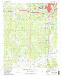
1980 Map of Oxford South
USGS Topo · Published 1981About this map
The Univ of Miss and the city of Oxford anchor the northern reaches of this topographic study, where the Courthouse and Hosp serve as central landmarks. To the south, the landscape transitions into the rolling terrain of Thacker Mountain, topped by the Lafayette Lookout Tower. The Illinois Central Gulf railroad line cuts a path through the territory, passing the small settlement of Taylor and the Weems Sch as it follows the drainage of East Goose Valley. Local rural life is evidenced by a network of country churches and burial grounds, including North Hopewell Ch and Church Grove Cem. Along the southern boundary, the Yocona River and its tributaries, such as Courtney Creek, define the hydrologic character of the region near the community of Markette.
Find a feature on this map
59 named features on this map. Tap any name to fly to it.
Don’t see what you’re looking for? This feature index may not catch every label — zoom into the map to look around manually.
Map Details
Editions of this 1980 Oxford South Map
2 editions found
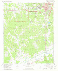
Other maps of this area

1940 · Oxford
USGS Topo · 1:62,500

1942 · Denmark
USGS Topo · 1:62,500

1943 · Denmark
USGS Topo · 1:62,500

1943 · Oxford
USGS Topo · 1:62,500

1954 · Water Valley
USGS Topo · 1:62,500

1954 · Water Valley West
USGS Topo · 1:24,000

1955 · Water Valley
USGS Topo · 1:62,500

1956 · Tupelo
USGS Topo · 1:250,000

1958 · Tupelo
USGS Topo · 1:250,000

1972 · Paris
USGS Topo · 1:24,000