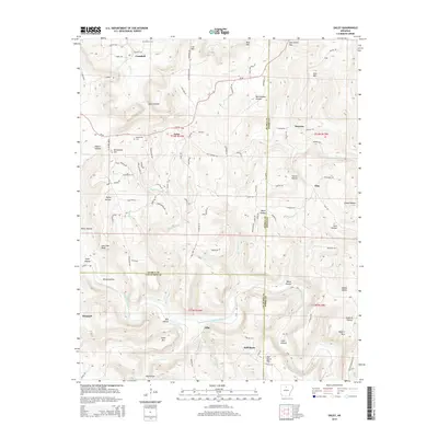
2014 Map of Oxley
USGS Topo · Published 2014About this map
The Middle Fork Little Red River carves a deep valley through this portion of the Ozark foothills, dictating the placement of early settlements and roads. The small community of Elba serves as a central point in this landscape, situated near the river and Half Moon. To the north, the terrain is marked by high points like Lee Mtn and Blue Mtn, with numerous hollows such as Avery Hollow and Rattlesnake Hollow branching off the main ridges.
Find a feature on this map
111 named features on this map. Tap any name to fly to it.
Don’t see what you’re looking for? This feature index may not catch every label — zoom into the map to look around manually.
Map Details
Editions of this 2014 Oxley Map
This is the sole edition of this map. No revisions or reprints were ever made.
Other maps of this area

1892 · Marshall
USGS Topo · 1:125,000

1892 · Mountain View
USGS Topo · 1:125,000

1894 · Mountain View
USGS Topo · 1:125,000

1894 · Marshall
USGS Topo · 1:125,000

1901 · Marshall
USGS Topo · 1:125,000

1956 · Russellville
USGS Topo · 1:250,000
1963 · Harriet
USGS Topo · 1:24,000

1963 · Leslie
USGS Topo · 1:24,000

1964 · Russellville
USGS Topo · 1:250,000
1965 · Botkinburg
USGS Topo · 1:24,000