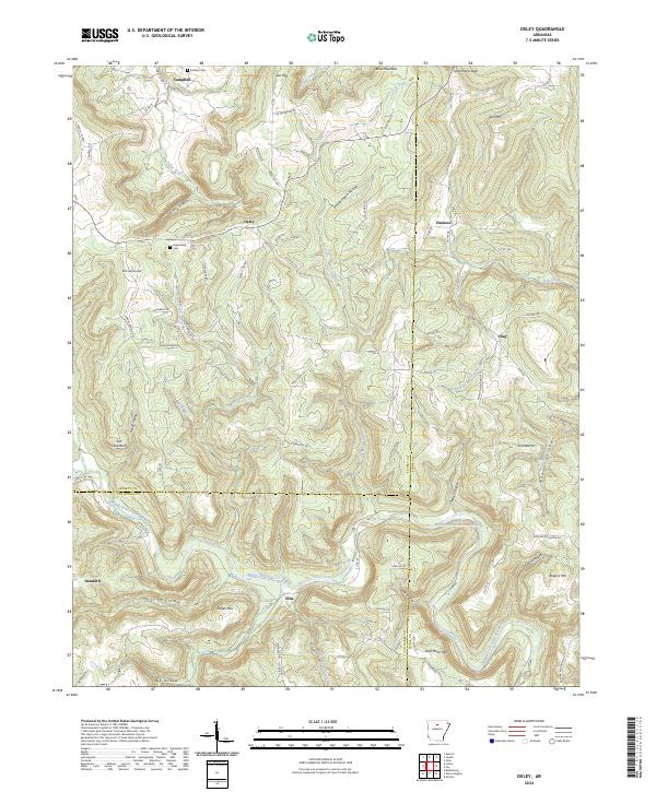
2024 Map of Oxley
USGS Topo · Published 2024About this map
The Middle Fork Little Red River carves through the Ozark foothills at the junction of Searcy, Van Buren, and Stone Counties, anchoring a landscape of isolated settlements and narrow hollows. Early transportation routes like Old Stagecoach and Old Hwy 66 suggest the historic movement of people through this challenging terrain. The map documents numerous small communities including Oxley, Harness, and Dennard, alongside family-named topographic features like McCutchen Hill and Styles Mtn. Geologic and local landmarks such as Salt Cave Bluff and Fawn Bluff overlook the river valley, while genealogical sites like Kuykendall Cem and Mabrey Cem provide essential markers for local history. The drainage pattern of Linn Creek, Tick Creek, and Hurricane Creek illustrates how the water network dictated the placement of farms and roads in these Arkansas uplands.
Find a feature on this map
97 named features on this map. Tap any name to fly to it.
Don’t see what you’re looking for? This feature index may not catch every label — zoom into the map to look around manually.
Map Details
Editions of this 2024 Oxley Map
This is the sole edition of this map. No revisions or reprints were ever made.
Other maps of this area

1892 · Marshall
USGS Topo · 1:125,000

1892 · Mountain View
USGS Topo · 1:125,000

1894 · Mountain View
USGS Topo · 1:125,000

1894 · Marshall
USGS Topo · 1:125,000

1901 · Marshall
USGS Topo · 1:125,000

1956 · Russellville
USGS Topo · 1:250,000
1963 · Harriet
USGS Topo · 1:24,000

1963 · Leslie
USGS Topo · 1:24,000

1964 · Russellville
USGS Topo · 1:250,000
1965 · Botkinburg
USGS Topo · 1:24,000