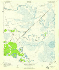
1943 Map of Oyster Creek
USGS Topo · Published 1959About this map
Bastrop Bayou and Austin Bayou snake through this low-lying coastal landscape, defining a region where water and rail dictated early settlement. The Missouri Pacific railroad cuts a straight diagonal across the wetlands, connecting small outposts like Mims and Pharr to the larger centers of Stratton Ridge and the coastal community of Oyster Creek. The map reveals a complex hydrologic network of sloughs and lakes, including Salt Lake and Square Island Lake, which separate the inland prairies from the Gulf marshes.
Find a feature on this map
30 named features on this map. Tap any name to fly to it.
Don’t see what you’re looking for? This feature index may not catch every label — zoom into the map to look around manually.
Map Details
Editions of this 1943 Oyster Creek Map
2 editions found
Other maps of this area

1943 · Oyster Creek
USGS Topo · 1:31,680

1943 · Jones Creek
USGS Topo · 1:31,680

1943 · Danbury
USGS Topo · 1:31,680

1943 · Freeport
USGS Topo · 1:31,680

1943 · Angleton
USGS Topo · 1:24,000

1943 · Christmas Point
USGS Topo · 1:24,000

1943 · Chocolate Bay
USGS Topo · 1:24,000

1943 · Snipe
USGS Topo · 1:31,680

1950 · Houston
USGS Topo · 1:250,000

1951 · Bay City
USGS Topo · 1:250,000