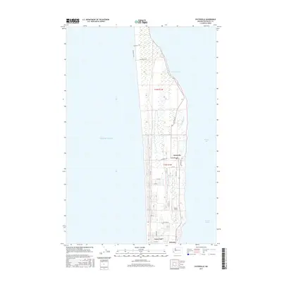
2017 Map of Oysterville
USGS Topo · Published 2017About this map
Oysterville sits prominently on the Long Beach Peninsula, a narrow finger of land separating the Pacific Ocean from the waters of Willapa Bay. This 2017 survey shows a landscape defined by its coastal geography, where the residential grids of Ocean Park and Nahcotta are bordered by extensive wetlands and tidal flats. To the north, the terrain becomes increasingly marshy toward Stackpole Harbor, punctuated by landmarks like Skating Lake and the Bearberry Trail. The map illustrates the local transportation network through routes like Stackpole Rd and Oysterville Rd, while the presence of Martin Airport and the post office at Oysterville highlight the established infrastructure of this seaside community. Tidal features like Goulter Slough and the Nahcotta Channel emphasize the ongoing importance of the bay to the region's character and economy.
Find a feature on this map
22 named features on this map. Tap any name to fly to it.
Don’t see what you’re looking for? This feature index may not catch every label — zoom into the map to look around manually.
Map Details
Editions of this 2017 Oysterville Map
This is the sole edition of this map. No revisions or reprints were ever made.
Other maps of this area

1938 · Cape Disappointment
USGS Topo · 1:62,500

1938 · Cape Shoalwater
USGS Topo · 1:62,500

1938 · Fort Columbia
USGS Topo · 1:62,500

1938 · South Bend
USGS Topo · 1:62,500

1940 · South Bend
USGS Topo · 1:62,500

1943 · Fort Columbia
USGS Topo · 1:62,500

1943 · Copalis Beach
USGS Topo · 1:250,000

1949 · Ocean Park
USGS Topo · 1:24,000

1949 · Long Island
USGS Topo · 1:24,000

1951 · Copalis Beach
USGS Topo · 1:250,000