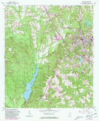
1960 Map of Ozark
USGS Topo · Published 1981About this map
The town of Ozark serves as the focal point for this survey of Dale County, Alabama, documenting the area's development from the late 1940s through its 1981 update. The landscape is defined by the sprawling Fort Rucker Military Reservation to the southwest, featuring the prominent Lake Tholocco and the Hooper Field Tower. Settlement patterns reveal a mix of traditional rural sites like Marley Mill and several country congregations, including Hopeful Primitive Ch and Old Salem Ch. The intersection of transportation and industry is evident where the Seaboard and Coast Line railroads meet near the municipal center. Beyond the town's Corporate Boundary, numerous small water bodies such as Roy Parker Lake and Mixon Lake dot the terrain, while the Dale County Public Lake lies to the northeast, illustrating the region's reliance on managed water resources for recreation and local utility.
Find a feature on this map
35 named features on this map. Tap any name to fly to it.
Don’t see what you’re looking for? This feature index may not catch every label — zoom into the map to look around manually.
Map Details
Editions of this 1960 Ozark Map
2 editions found
Other maps of this area

1942 · Enterprise
USGS Topo · 1:125,000

1948 · Ozark
USGS Topo · 1:62,500

1948 · Brundidge
USGS Topo · 1:62,500

1950 · Ozark
USGS Topo · 1:62,500

1950 · Enterprise
USGS Topo · 1:62,500

1950 · Brundidge
USGS Topo · 1:62,500

1953 · Dothan
USGS Topo · 1:250,000

1954 · Dothan
USGS Topo · 1:250,000

1955 · Dothan
USGS Topo · 1:250,000

1960 · Ewell
USGS Topo · 1:24,000