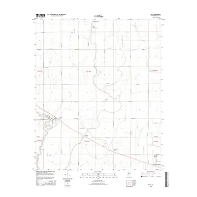
2015 Map of Pace
USGS Topo · Published 2015About this map
Pace and Victor sit within the rich agricultural lands of the Mississippi Delta, a landscape defined by a complex network of bayous and former river channels. The terrain is marked by the winding paths of Snake Cr and Bogue Phalia, which drain the flat bottomlands alongside various oxbow remnants like Sixmile Lake and Kimball Lake. This map captures the area's rural character through its numerous family and community landmarks, including the Smith and Williams Cem and Bellamy Chapel to the north.
Find a feature on this map
72 named features on this map. Tap any name to fly to it.
Don’t see what you’re looking for? This feature index may not catch every label — zoom into the map to look around manually.
Map Details
Editions of this 2015 Pace Map
This is the sole edition of this map. No revisions or reprints were ever made.
Other maps of this area

1931 · Drew
USGS Topo · 1:48,000

1934 · Cleveland
USGS Topo · 1:62,500

1935 · Mound Bayou
USGS Topo · 1:62,500

1939 · Pace
USGS Topo · 1:62,500

1939 · Choctaw
USGS Topo · 1:62,500

1940 · Cleveland
USGS Topo · 1:62,500

1953 · Greenwood
USGS Topo · 1:250,000

1956 · Greenwood
USGS Topo · 1:250,000
1966 · Merigold
USGS Topo · 1:24,000

1966 · Cleveland
USGS Topo · 1:24,000