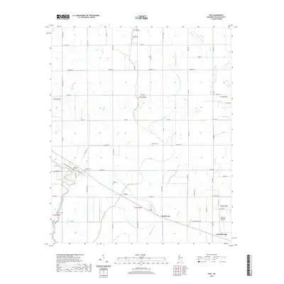
2020 Map of Pace
USGS Topo · Published 2020About this map
The town of Pace and the neighboring community of Victor sit amidst the flat, fertile delta lands of Bolivar County, defined by a complex network of bayous and drainage systems. This landscape is shaped by the winding courses of Bogue Phalia and the branching W Bogue Hasty, with large tracts like Merigold Brake indicating the low-lying, wetland character of the region. The map reveals a high density of small family and community burial grounds, including Bellamy Chapel Cem, Smith and Williams Cem, and Saint Peter Cem, which serve as vital markers for genealogical research in this rural corridor.
Find a feature on this map
73 named features on this map. Tap any name to fly to it.
Don’t see what you’re looking for? This feature index may not catch every label — zoom into the map to look around manually.
Map Details
Editions of this 2020 Pace Map
This is the sole edition of this map. No revisions or reprints were ever made.
Other maps of this area

1931 · Drew
USGS Topo · 1:48,000

1934 · Cleveland
USGS Topo · 1:62,500

1935 · Mound Bayou
USGS Topo · 1:62,500

1939 · Pace
USGS Topo · 1:62,500

1939 · Choctaw
USGS Topo · 1:62,500

1940 · Cleveland
USGS Topo · 1:62,500

1953 · Greenwood
USGS Topo · 1:250,000

1956 · Greenwood
USGS Topo · 1:250,000
1966 · Merigold
USGS Topo · 1:24,000

1966 · Cleveland
USGS Topo · 1:24,000