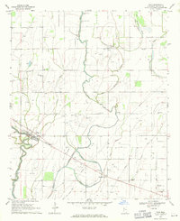
1969 Map of Pace
USGS Topo · Published 1971About this map
Bogue Phalia and its winding tributaries define the agricultural character of Bolivar County during this late 1960s survey. The landscape is a network of drainage and transport, anchored by the town of Pace, where a dedicated Landing Strip and Pace Center Sch serve the local population. The map reveals a deeply rooted community structure, evidenced by the high density of rural churches and cemeteries such as Bellamy Chapel Cem, Smith and Williams Cem, and Rising Star Ch.
Find a feature on this map
38 named features on this map. Tap any name to fly to it.
Don’t see what you’re looking for? This feature index may not catch every label — zoom into the map to look around manually.
Map Details
Editions of this 1969 Pace Map
This is the sole edition of this map. No revisions or reprints were ever made.
Other maps of this area

1931 · Drew
USGS Topo · 1:48,000

1934 · Cleveland
USGS Topo · 1:62,500

1935 · Mound Bayou
USGS Topo · 1:62,500

1939 · Pace
USGS Topo · 1:62,500

1939 · Choctaw
USGS Topo · 1:62,500

1940 · Cleveland
USGS Topo · 1:62,500

1953 · Greenwood
USGS Topo · 1:250,000

1956 · Greenwood
USGS Topo · 1:250,000
1966 · Merigold
USGS Topo · 1:24,000

1966 · Cleveland
USGS Topo · 1:24,000