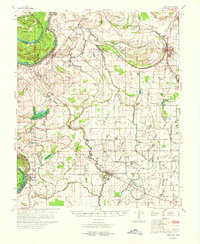
1970 Map of Pace
USGS Topo · Published 1970About this map
Bogue Phalia meanders through the heart of this Bolivar County landscape, anchoring a network of drainage bayous and small settlements along the Illinois Central Railroad. The map documents a period when rural life in the Delta was centered on small community hubs like Gunnison, Pace, and Beulah, each supported by numerous local institutions such as Bethlehem Ch and New Bethel Ch. The proximity to the Old Mississippi River and its remnant features, including Beulah Lake and Lake Concordia, illustrates the dynamic nature of the river's path and its influence on the surrounding agricultural land.
Find a feature on this map
124 named features on this map. Tap any name to fly to it.
Don’t see what you’re looking for? This feature index may not catch every label — zoom into the map to look around manually.
Map Details
Editions of this 1970 Pace Map
This is the sole edition of this map. No revisions or reprints were ever made.
Other maps of this area

1930 · Mellwood
USGS Topo · 1:62,500

1931 · Drew
USGS Topo · 1:48,000

1933 · Lamont
USGS Topo · 1:62,500

1934 · Cleveland
USGS Topo · 1:62,500

1935 · Clarksdale
USGS Topo · 1:62,500

1935 · Mound Bayou
USGS Topo · 1:62,500

1939 · Henrico
USGS Topo · 1:62,500

1939 · Pace
USGS Topo · 1:62,500

1939 · Clarksdale
USGS Topo · 1:62,500

1939 · Big Island
USGS Topo · 1:62,500