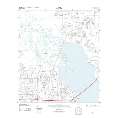
2012 Map of Pace
USGS Topo · Published 2012About this map
Escambia Bay and the complex delta of the Escambia River dominate this 2012 survey, revealing a landscape defined by water and rapid residential expansion. The intricate network of waterways, including Saultsman Bayou, Simpson River, and Woodbine Bayou, creates a maze of islands such as Noriegas Island and Brosnaham Island. This period shows the established campus of the University of West Florida bordering the river marshes, while the residential reaches of Riverview and Floridatown stretch toward the eastern shoreline. To the north, the Spencer Naval Outlying Field and the Chemstrand Pier represent the area's ongoing military and industrial footprints. For those tracing local heritage, the map identifies the Whitmire Cem and smaller settlements like Yniestra along the southern bayfront, capturing the interface between the dense suburban grid and the tidal wetlands of the Gulf Coast.
Find a feature on this map
246 named features on this map. Tap any name to fly to it.
Don’t see what you’re looking for? This feature index may not catch every label — zoom into the map to look around manually.
Map Details
Editions of this 2012 Pace Map
This is the sole edition of this map. No revisions or reprints were ever made.
Other maps of this area

1920 · Milton
USGS Topo · 1:62,500

1921 · Pensacola
USGS Topo · 1:62,500

1921 · Fort Barrancas
USGS Topo · 1:62,500

1921 · Muscogee
USGS Topo · 1:62,500

1941 · Fort Barrancas
USGS Topo · 1:62,500

1941 · Muscogee
USGS Topo · 1:62,500

1941 · Pensacola
USGS Topo · 1:62,500

1941 · Milton
USGS Topo · 1:62,500

1942 · Pensacola
USGS Topo · 1:62,500

1943 · Muscogee
USGS Topo · 1:62,500