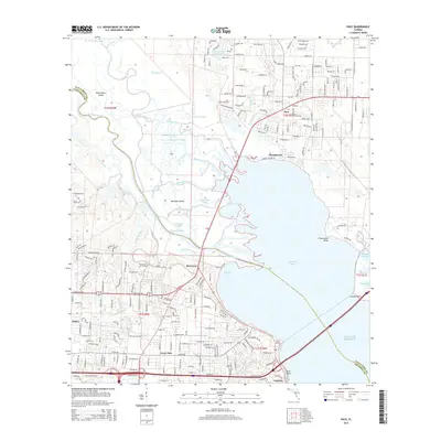
2015 Map of Pace
USGS Topo · Published 2015About this map
Escambia Bay and the complex wetlands of the Escambia River delta define this transition between suburban development and the aquatic wilderness of the Florida Panhandle. The landscape is characterized by a dense network of winding waterways, including Woodbine Bayou, Bannahassee River, and the Simpson River, which carve out major landforms like Brosnaham Island and Noriegas Island.
Find a feature on this map
58 named features on this map. Tap any name to fly to it.
Don’t see what you’re looking for? This feature index may not catch every label — zoom into the map to look around manually.
Map Details
Editions of this 2015 Pace Map
This is the sole edition of this map. No revisions or reprints were ever made.
Other maps of this area

1920 · Milton
USGS Topo · 1:62,500

1921 · Pensacola
USGS Topo · 1:62,500

1921 · Fort Barrancas
USGS Topo · 1:62,500

1921 · Muscogee
USGS Topo · 1:62,500

1941 · Fort Barrancas
USGS Topo · 1:62,500

1941 · Muscogee
USGS Topo · 1:62,500

1941 · Pensacola
USGS Topo · 1:62,500

1941 · Milton
USGS Topo · 1:62,500

1942 · Pensacola
USGS Topo · 1:62,500

1943 · Muscogee
USGS Topo · 1:62,500