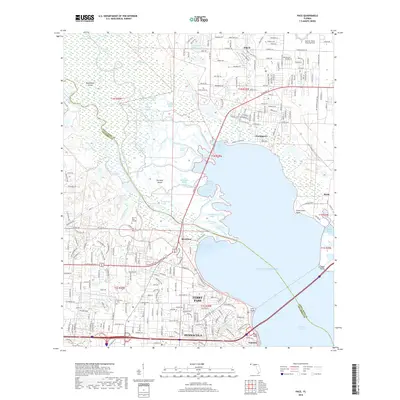
2018 Map of Pace
USGS Topo · Published 2018About this map
The Escambia River system dominates this landscape, branching into complex distributaries like the Little Simpson River and Saultsman Bayou as it meets the bay. These wetlands and river channels separate the residential growth of Pace and Floridatown in Santa Rosa County from the extensive campus of the University of West Florida across the water. The intricate geography of Brosnaham Island and Noriegas Island highlights the deltaic nature of the region before the land firms up for the settlements of Ferry Pass and Pensacola to the south.
Find a feature on this map
154 named features on this map. Tap any name to fly to it.
Don’t see what you’re looking for? This feature index may not catch every label — zoom into the map to look around manually.
Map Details
Editions of this 2018 Pace Map
This is the sole edition of this map. No revisions or reprints were ever made.
Other maps of this area

1920 · Milton
USGS Topo · 1:62,500

1921 · Pensacola
USGS Topo · 1:62,500

1921 · Fort Barrancas
USGS Topo · 1:62,500

1921 · Muscogee
USGS Topo · 1:62,500

1941 · Fort Barrancas
USGS Topo · 1:62,500

1941 · Muscogee
USGS Topo · 1:62,500

1941 · Pensacola
USGS Topo · 1:62,500

1941 · Milton
USGS Topo · 1:62,500

1942 · Pensacola
USGS Topo · 1:62,500

1943 · Muscogee
USGS Topo · 1:62,500