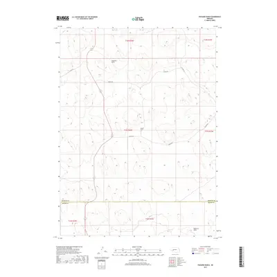
2017 Map of Packard Ranch
USGS Topo · Published 2017About this map
Packard Ranch sits as the central landmark of this Sandhills landscape, situated in the vast ranching country of Arthur County near the Keith County line. The terrain is defined by a rhythmic series of northwest-to-southeast trending depressions, most notably Thoelecke Valley in the north and Wildhorse Valley at the southern edge. This 2017 survey reveals the sparse but essential transportation network that supports these remote holdings, where unpaved corridors like Wilson Rd and Corfield Rd connect isolated homesteads across the dunes. The map illustrates the persistent structure of the Public Land Survey System, with township and range lines like t17n r38w dividing the open range into discrete blocks. This geography highlights a modern ranching economy that remains deeply rooted in the historical land divisions of the Nebraska panhandle, where name-bearing valleys serve as the primary markers for navigation and settlement.
Find a feature on this map
14 named features on this map. Tap any name to fly to it.
Don’t see what you’re looking for? This feature index may not catch every label — zoom into the map to look around manually.
Map Details
Editions of this 2017 Packard Ranch Map
This is the sole edition of this map. No revisions or reprints were ever made.
Other maps of this area

1897 · Ogallala
USGS Topo · 1:125,000

1900 · Ogallala
USGS Topo · 1:125,000

1949 · Arthur
USGS Topo · 1:62,500

1950 · Velma
USGS Topo · 1:62,500

1950 · Arthur
USGS Topo · 1:62,500

1954 · North Platte
USGS Topo · 1:250,000

1956 · North Platte
USGS Topo · 1:250,000

1957 · North Platte
USGS Topo · 1:250,000

1967 · North Platte
USGS Topo · 1:250,000

1971 · Martin
USGS Topo · 1:24,000