
1949 Map of Packsaddle Mtn
USGS Topo · Published 1959About this map
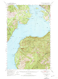
Lake Pend Oreille dominates this 1940s landscape, its deep waters and irregular shoreline defining the local economy and settlement patterns of northern Idaho. Along the eastern shore, the Northern Pacific railroad tracks hug the coastline through East Hope and Hope, while the David Thompson State Game Preserve occupies the peninsula nearby. The map reveals a region transitioning from early resource extraction to recreation and preservation, with numerous small mines like the Sulphide Mine and Green Monarch Mine dotting the steep slopes of Packsaddle Mtn and the surrounding national forests.
Find a feature on this map
77 named features on this map. Tap any name to fly to it.
Don’t see what you’re looking for? This feature index may not catch every label — zoom into the map to look around manually.
Map Details
Editions of this 1949 Packsaddle Mtn Map
3 editions found
Other maps of this area

1901 · Sandpoint
USGS Topo · 1:125,000

1903 · Rathdrum
USGS Topo · 1:125,000

1909 · Cataldo
USGS Topo · 1:125,000

1911 · Cataldo
USGS Topo · 1:125,000

1911 · Priest Lake
USGS Topo · 1:250,000

1911 · Sandpoint
USGS Topo · 1:125,000

1913 · Priest Lake
USGS Topo · 1:250,000

1951 · Packsaddle Mtn
USGS Topo · 1:62,500

1951 · Clark Fork
USGS Topo · 1:62,500

1951 · Mt Pend Oreille
USGS Topo · 1:62,500