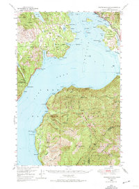
1949 Map of Packsaddle Mtn
USGS Topo · Published 1974About this map
Lake Pend Oreille dominates this mid-century survey, its deep waters and irregular shoreline defining the geography of Bonner County. Along its northern reaches, the Northern Pacific railroad tracks hug the coast, connecting the lakeside communities of Hope and East Hope. The presence of the Newman Sch and the Broten PO north of Gamble Lake indicates the dispersed but established rural life of the era, while the David Thompson State Game Preserve marks a significant commitment to conservation in the panhandle.
Find a feature on this map
88 named features on this map. Tap any name to fly to it.
Don’t see what you’re looking for? This feature index may not catch every label — zoom into the map to look around manually.
Map Details
Editions of this 1949 Packsaddle Mtn Map
3 editions found
Other maps of this area

1901 · Sandpoint
USGS Topo · 1:125,000

1903 · Rathdrum
USGS Topo · 1:125,000

1909 · Cataldo
USGS Topo · 1:125,000

1911 · Cataldo
USGS Topo · 1:125,000

1911 · Priest Lake
USGS Topo · 1:250,000

1911 · Sandpoint
USGS Topo · 1:125,000

1913 · Priest Lake
USGS Topo · 1:250,000

1949 · Packsaddle Mtn
USGS Topo · 1:62,500

1951 · Packsaddle Mtn
USGS Topo · 1:62,500

1951 · Clark Fork
USGS Topo · 1:62,500