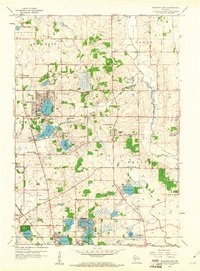
1959 Map of Paddock Lake
USGS Topo · Published 1961About this map
The Richard I Bong Air Force Base occupies a significant footprint in the northwest corner of this Kenosha County landscape, illustrating mid-century military infrastructure alongside established rural communities. The map highlights a dense concentration of glacial lakes, including Paddock Lake, Hooker Lake, and Lake Shangrila, which drove the local development of residential clusters and recreational sites like the Union League Boys Camp.
Find a feature on this map
46 named features on this map. Tap any name to fly to it.
Don’t see what you’re looking for? This feature index may not catch every label — zoom into the map to look around manually.
Map Details
Editions of this 1959 Paddock Lake Map
3 editions found
Other maps of this area

1892 · Racine
USGS Topo · 1:62,500

1893 · Silver Lake
USGS Topo · 1:62,500

1905 · Racine
USGS Topo · 1:62,500

1906 · Silver Lake
USGS Topo · 1:62,500

1906 · Waukegan
USGS Topo · 1:62,500

1908 · Waukegan
USGS Topo · 1:62,500

1920 · Grays Lake
USGS Topo · 1:62,500

1923 · Grays Lake
USGS Topo · 1:62,500

1954 · Rockford
USGS Topo · 1:250,000

1955 · Rockford
USGS Topo · 1:250,000